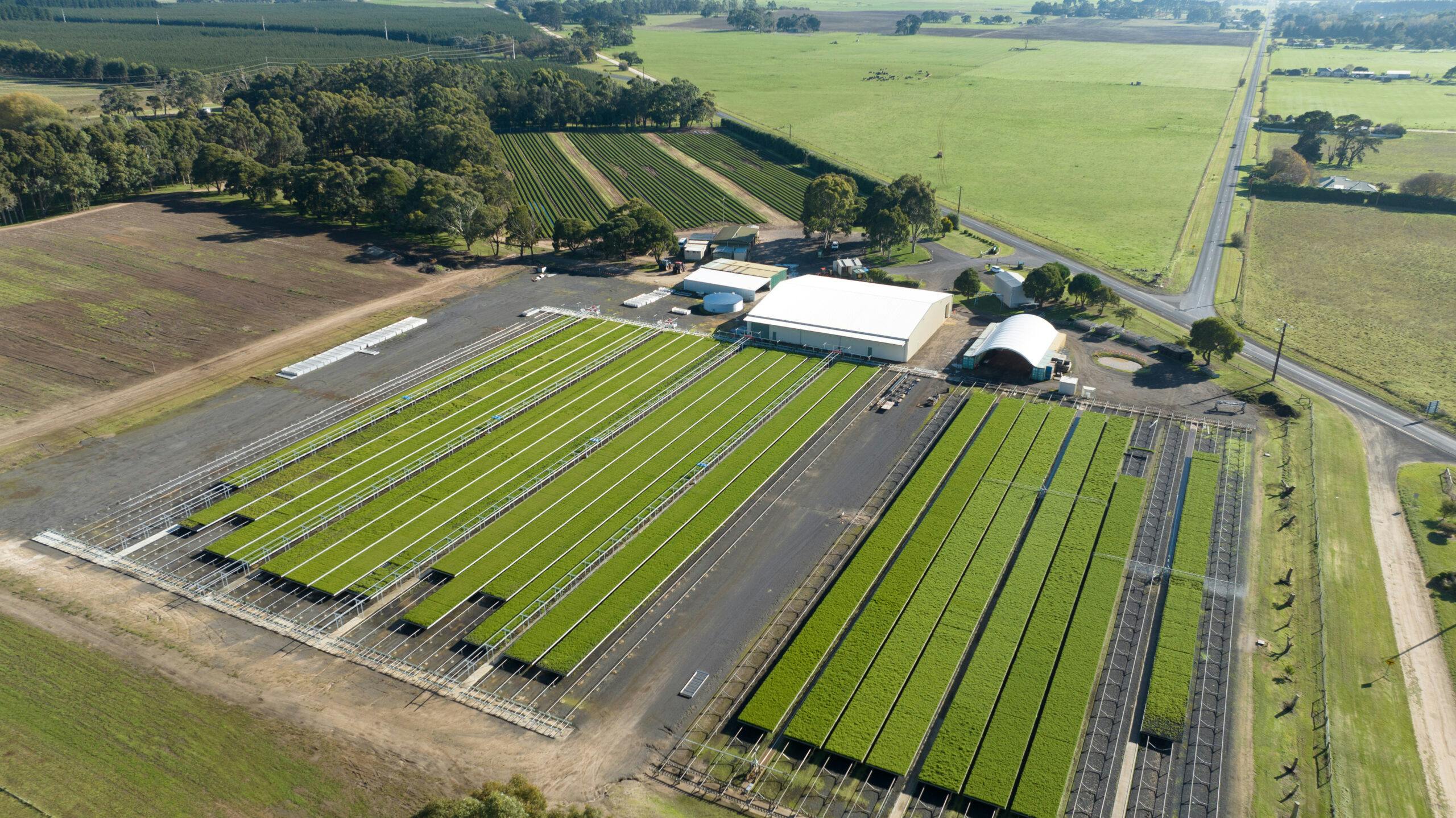
Donald Creek Catchment Study 2020-2027
OneFortyOne New Zealand has partnered with the Ministry for Primary Industries (MPI) in a $2.7 million sediment study.
The project has established a long-term monitoring program within adjacent catchments in the OneFortyOne New Zealand Ltd (OFO) forest estate, to study the performance of sediment control practices utilised in forest harvesting. The catchments are of similar size-area, geology and topography, located in Pinus radiata plantations of similar age. The aim of the study is to determine the most effective ways of reducing sediment loss resulting from forestry.
This project is in collaboration with Cawthron Institute, Envirolink, Manaaki Whenua Landcare Research and independent scientific consultants, with support from Tasman District Council. It is jointly funded by Ministry of Primary Industry and OneFortyOne.
Outcomes
The project aims to quantify:
- How much sediment leaves a harvesting site under current and improved sediment control practices.
- Ecological effects of sediment generation and delivery.
- Operating costs of implementing current and improved practices.
Location
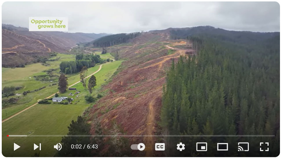
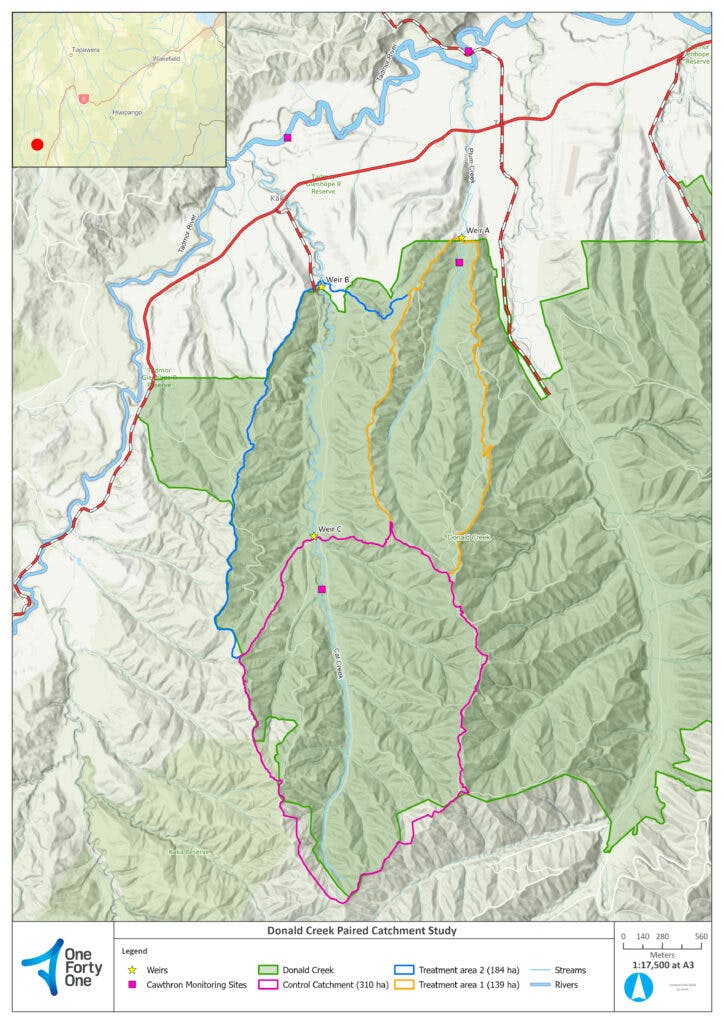
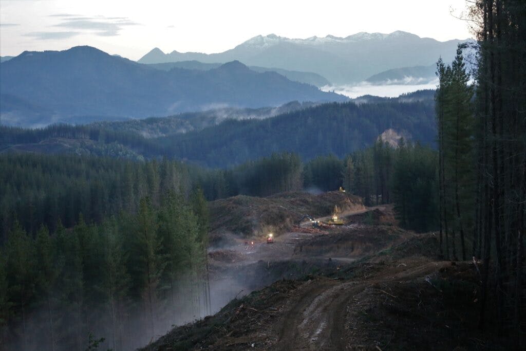
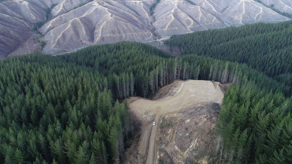
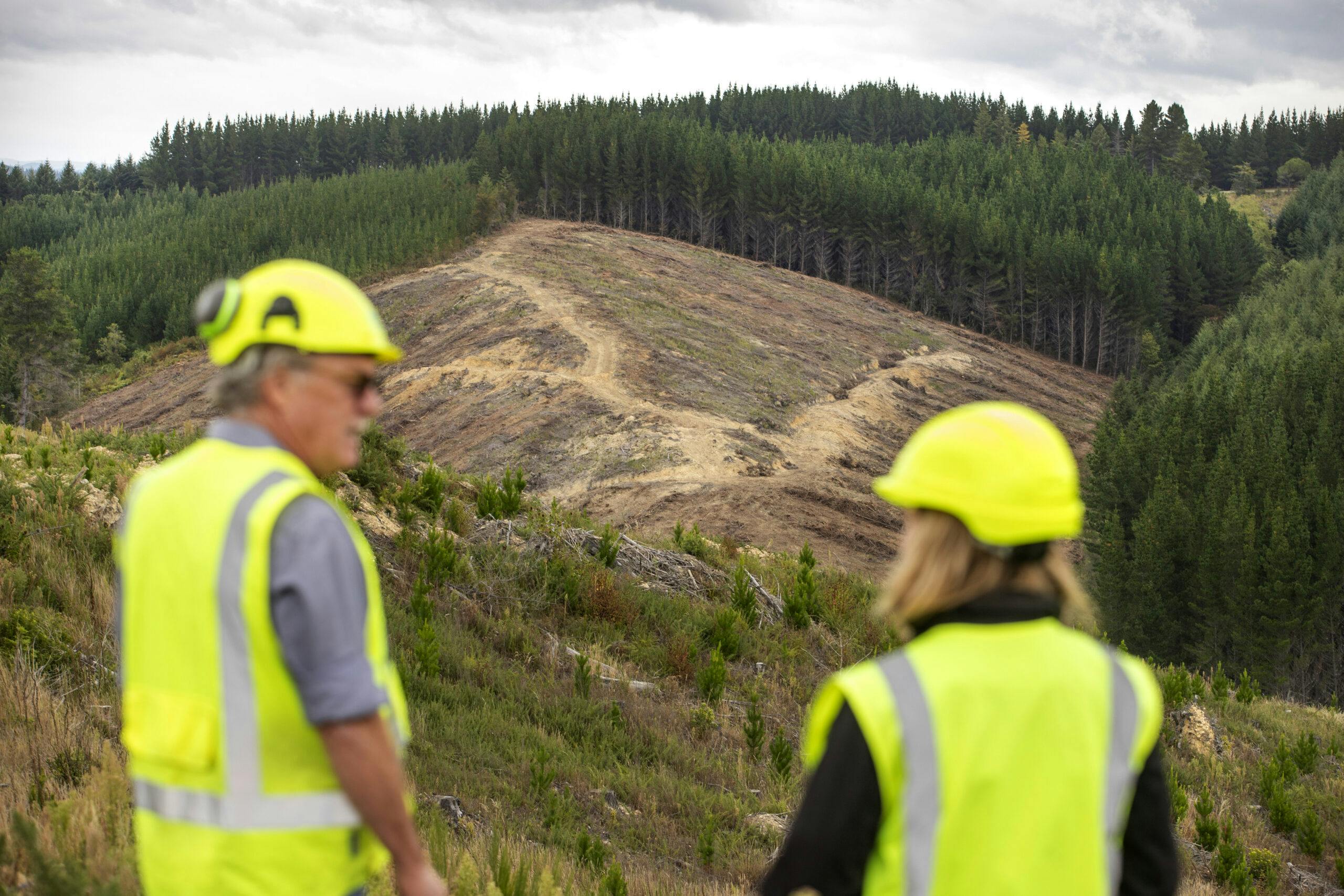
The study location is in OneFortyOne managed Golden Downs forest (Ngāti Toa land) in the Donald Creek Block near Tapawera. The two creeks to be monitored for ecological and sediment outputs are Cat Creek and Plum Creek, as well as downstream monitoring sites set up within the Tadmor River.
Project timeline
- June 2020-December 2020 – Monitoring infrastructure installed at Control and Treatment Area 1 (TA 1). Read summary.
- January 2021-June 2021 – Sediment load and stream health baselines documented in Control and TA 1. Read summary.
- July 2021-June 2022 – Earthworks and harvesting commenced in TA 1. Read summary.
- July 2022-June 2023 – Progress report for TA 1 and monitoring infrastructure installed in Treatment Area 2 (TA 2). Read summary.
- July 2023-June 2024 – Monitoring continues and progress report for TA 1.
- July 2024-June 2025 – Design of improved erosion sediment controls (ESC).
- July 2025-June 2026 – Implementation of improved ESC in TA 2 and interim report for TA 1.
- July 2026-June 2027 – Harvesting commences and progress report for TA 2.
Project Team
Dr Les Basher
Research Associate, Manaaki Whenua - Landcare Research
Role – document erosion and sediment control (ESC) practices; carry out baseline survey of erosion status and undertake annual and post storm surveys of erosion sources and their relationship with ESC practices; relate the results of suspended sediment measurements to understanding of erosion processes, sediment sources and harvesting practice; assist identification of options for improving performance of ESC practices.

Karen Shearer
Freshwater Ecologist, Cawthron Institute
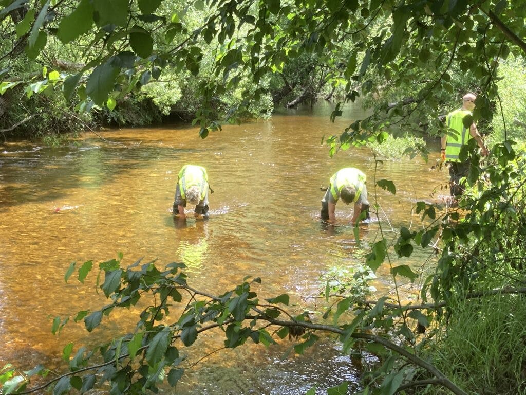
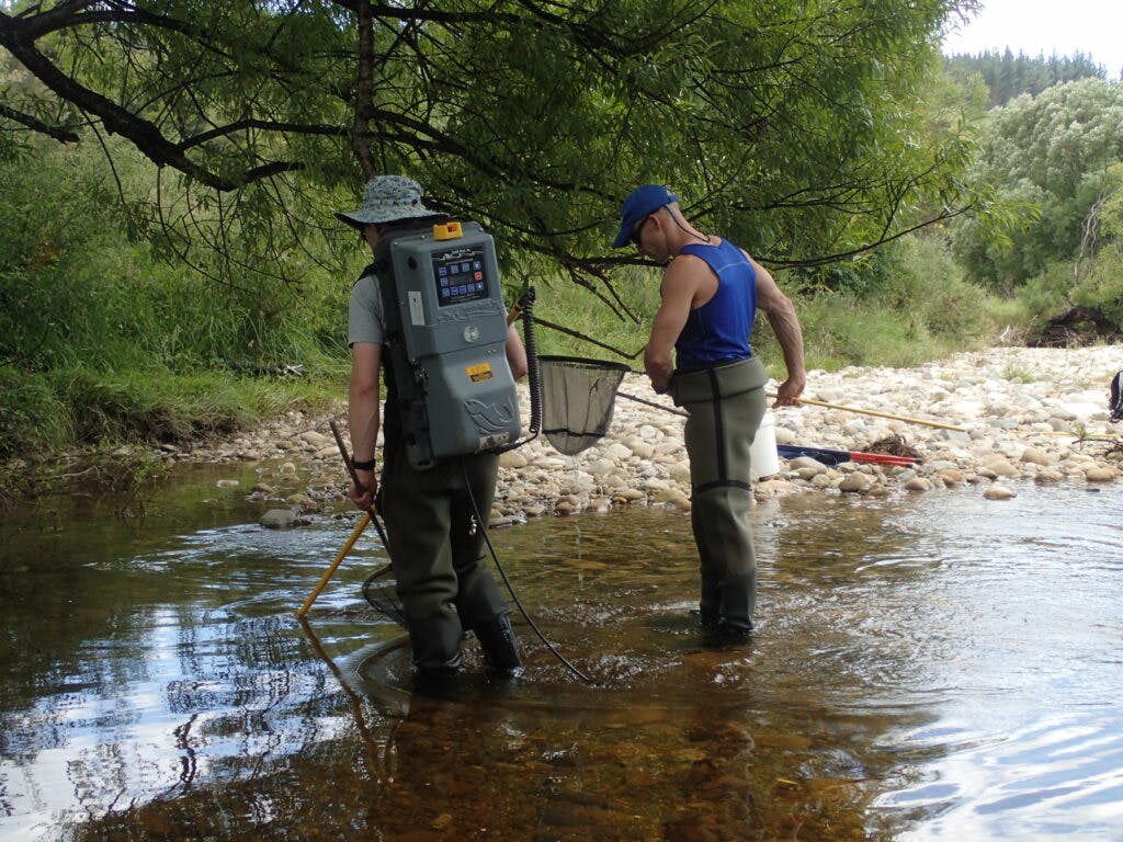
Role – document changes in ecological condition of freshwater streams post-harvest through quarterly water quality and bi-annual ecological monitoring. The ecological monitoring includes assessing macroinvertebrates, deposited fine sediment, periphyton (river algae) cover, general instream habitat condition, organic matter decomposition, and fish community structure (through electric fishing and eDNA).
Corina Stebbings
Hydrology Field Technician, Envirolink
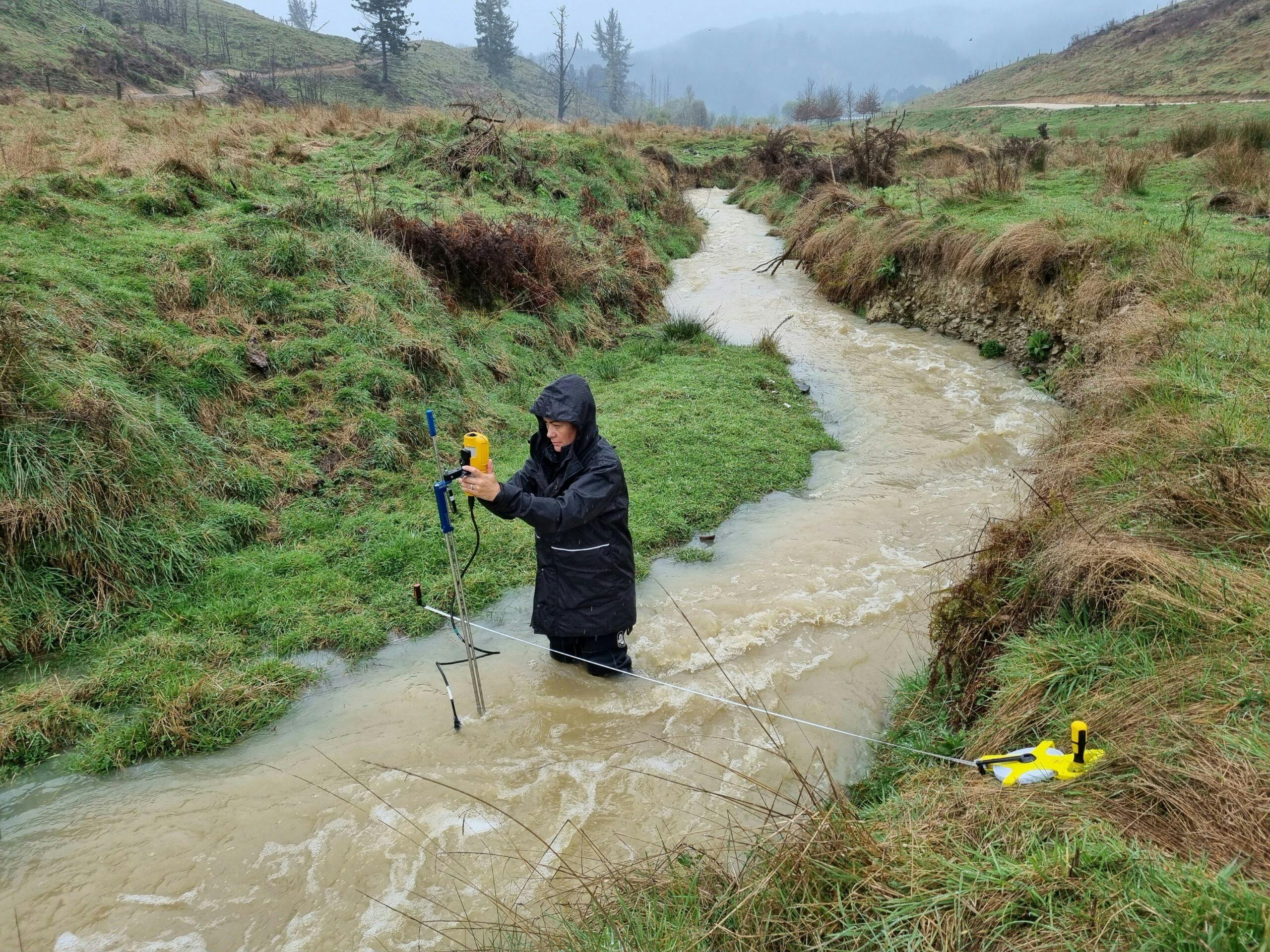
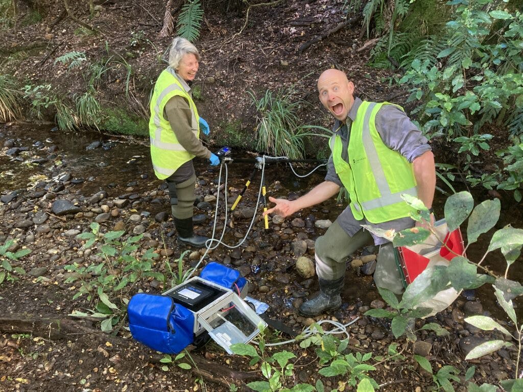
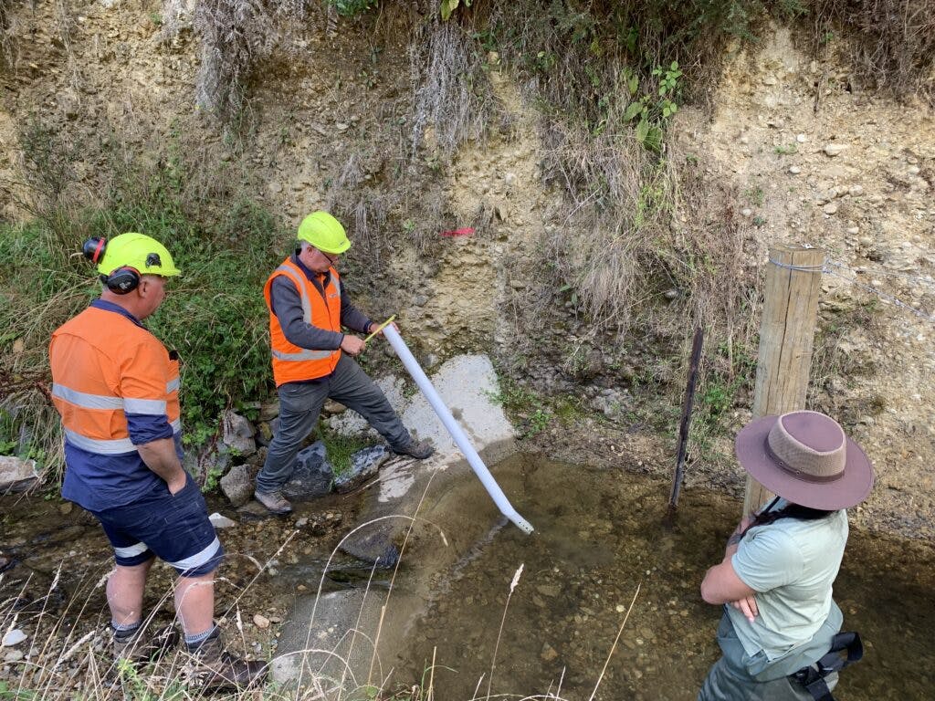
Role – Maintain weir monitoring sites to ensure continuous and accurate data for analysis. Measure stream flows to develop waterlevel/discharge rating curves and cross-sectional areas to identify changes in bedload. Collect flood flow samples to determine the correlation between turbidity and suspended sediment. Work closely with the project partners and particularly with the Research Consultant.
Dr Murray Hicks
Research Consultant
Role – advise on suspended sediment load field data collection, including turbidity and discharge monitoring; calibrate turbidity records to suspended sediment concentration; calculate storm-event and cumulative suspended sediment loads and report biannually; advise on bedload monitoring; assist interpretation of sediment load results for impact of harvesting and ESC practice; general advice on study strategy.

Jo Field
Environment Manager - OneFortyOne New Zealand Forests
Role – Project manage the study and technical support to the Partners, particularly MWLR with ESC data collection; Envirolink with weir and equipment maintenance; and Cawthron with quarterly water monitoring.

Graham Paterson CA
Commercial Finance Manager, OneFortyOne New Zealand
Role – liaising with MPI on funding, and working with project manager to manage finances and milestone reporting.
Summary of Progress
June 2020-December 2020 – Monitoring infrastructure installed at Control and Treatment Area 1 (TA 1)
Establish monitoring infrastructure in the control and treatment catchments.
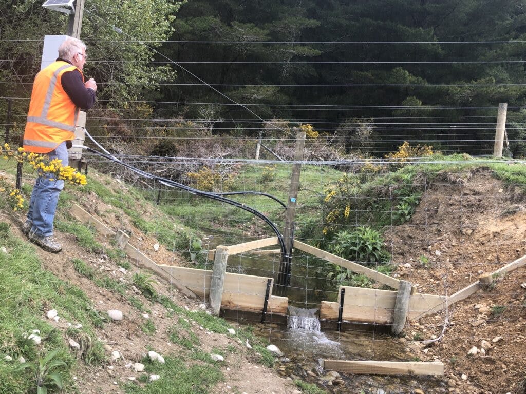
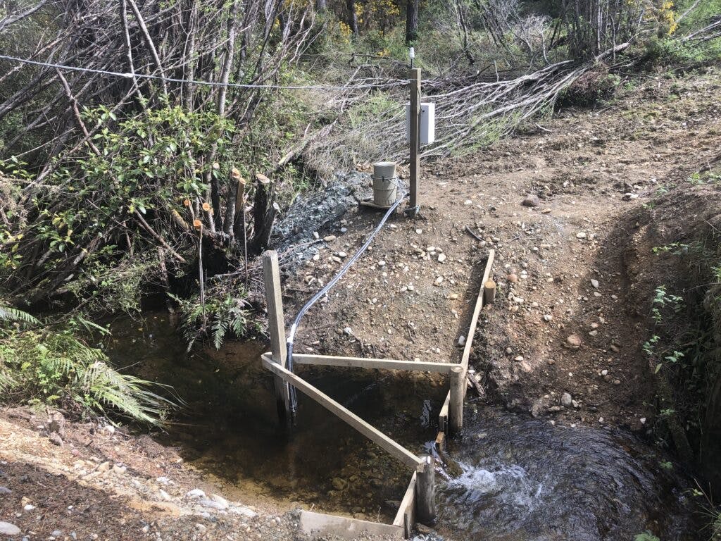
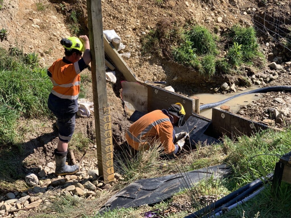
Weirs were constructed and infrastructure was set up at weirs A and C, and baseline monitoring for flow and turbidity commenced.
Weirs A and C suffered bank erosion from a significant storm event in November 2020, causing holes in the bank at each site. These sites were repaired.
January-June 2021 – Sediment load and stream health baselines documented in Control and TA 1
Baseline sediment load quantified, and baseline stream health documented.
Harvest planning and road lining in preparation for 2021 harvest.
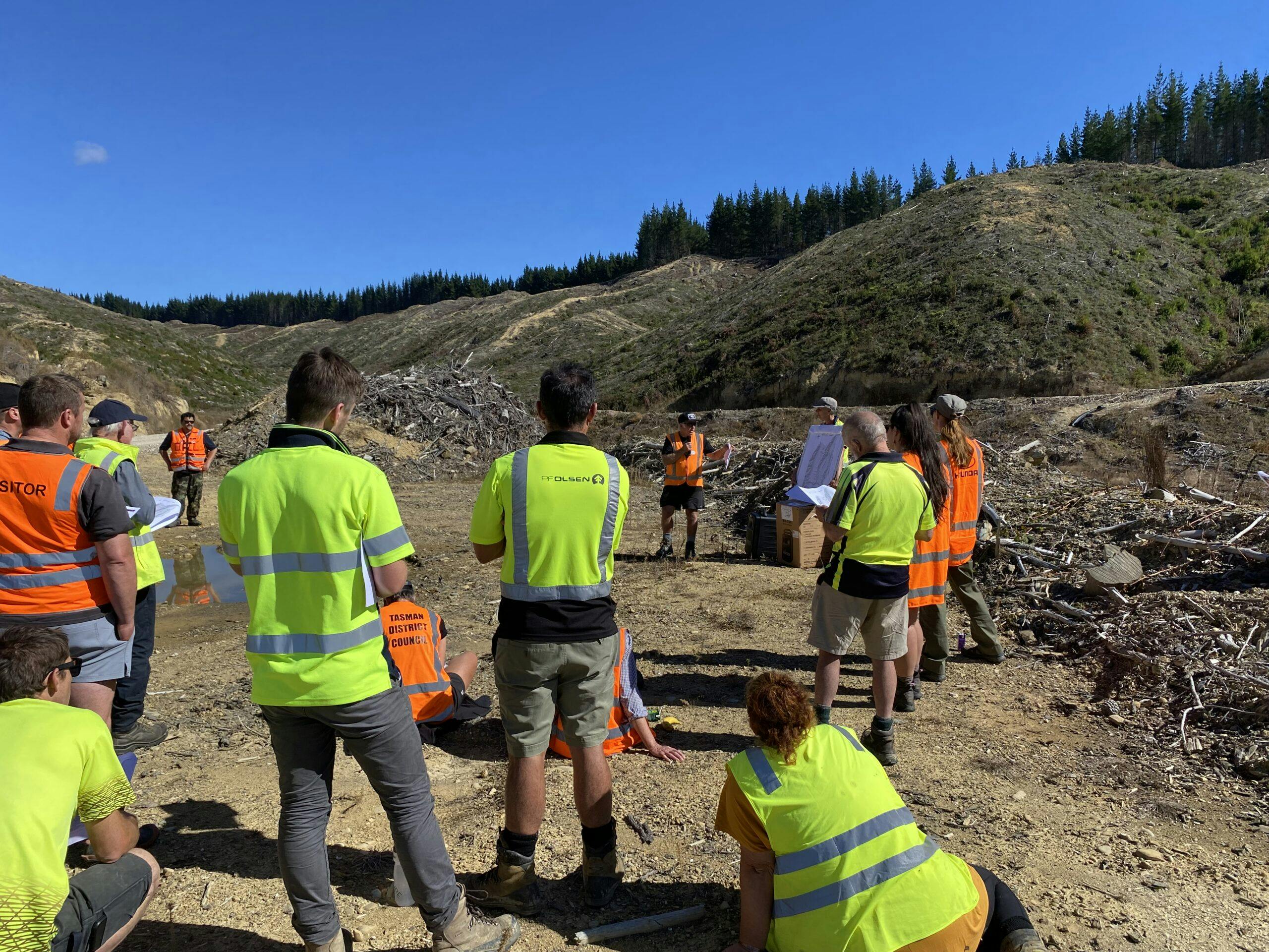
Field trip for local stakeholders.
Roadline harvesting and earthworks on the roads and landings within treatment area 1 commenced in April 2021.
Stakeholder field trip held in May 2021, involving the project partners presenting to council reps, MPI, forest industry reps, Fish and Game. Iwi were unable to attend.
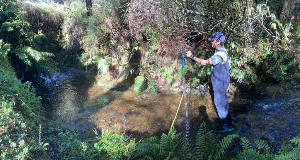
Stream health monitoring sites established above weir A (Plum Creek) and weir C (Cat Creek) within the study catchments, and control sites on the Tadmor River below Cat Creek confluence and Plum Creek confluence.
Baseline data from all four monitoring sites was collected and the first ecological assessment report showed the cover of fine sediment varies between seasons and were generally low; and relatively good habitat and cover for instream fauna present at all sites; and macroinvertebrates and fish fauna indicated relatively healthy streams.
At end-May there was a significant daily rainfall event totalling 65mm for the 24-hour period. It was the first significant rainfall event since both weir sites became fully operational and was the highest daily rainfall total to date. This was also the second year under La Nina.
Whenever planning an outdoor event, plan for the worst! As a result of high winds, the stakeholder field trip was moved to the local Tapawera hotel.
July 2021-June 2022 – Earthworks and harvesting commenced in TA 1
Progress report data for harvest period in treatment catchment
Earthworks and harvesting in treatment area 1 commenced.
Characterisation of erosion processes and sediment sources in the cutover and during storms undertaken.
Continued sediment and stream monitoring data collection.
Despite an excessive wet 12 months, harvesting within the treatment area 1 was completed early in this milestone. Earthworks were completed during this period.
Significant rain events in July, September 2021 and February 2022 provided high flow and turbidity data required for the project to ascertain effects of earthworks and harvesting erosion sediment controls (ESC) in treatment area 1.
The ESCs installed throughout treatment area 1 (except for three landings due to contractors still harvesting in these areas/utilising the landings for processing) have been inventoried. The final ESCs will be captured in July/August 2022 when harvesting is finished.
The media campaign between OFO and MPI raised high interest nationally and locally with the project, including a TV segment on Rural Delivery.
July 2022-June 2023 – Progress report for TA 1 and monitoring infrastructure installed in Treatment Area 2 (TA 2)
Treatment area 1 progress report and Infrastructure Install
Established monitoring infrastructure at Weir B.
Harvesting completed in the treatment area 1 above Weir A.
Catchment ground cover, earthworks rehabilitation and sediment sources monitored for recovery.
Stream health surveys after harvest activities conducted and results were analysed in relation to suspended sediment load from both the control and treatment catchment including consideration of climate variables.
Two field trips held with over 80 attendees. Project partners attended and presented on their respective subject matter.
Quarterly water surveys by Cawthron indicated water quality at all sites is generally high. Nutrients and faecal indicator bacterial concentrations are generally low.
Considering the paired forested stream catchments in the Donald Creek forestry block, the only indication that tree harvesting in Treatment Area 1 (Plum Creek) was affecting water quality was spot temperatures are higher than those recorded on previous years’ sampling and relative to the Control Catchment (Cat Creek) temperatures in the December 2022 and February 2023 water quality results.
In the post-harvested treatment area 1, it was found the shading of the stream had decreased and there was an increase in streambank erosion. There was also a general decrease in instream habitat quality for macroinvertebrates and fish.
To date, there has been no quantitative or anecdotal evidence to suggest the harvesting of Treatment Area 1 has affected the freshwater ecology in the Tadmor River (below the Plum Creek sampling site). This is one of the two control monitoring sites outside the study area.
As a result of a storm event in July 2022, Weir A burst and had extensive repairs. Weir C also required repairs. Weir B was built to a different specification in discussion with Tasman District Council principal hydrologist.
The science partners expanded to include sediment expert Dr Murray Hicks, working with Envirolink on sediment loads and turbidity.
Acknowledgements
Thank you to the Tasman District Council and Taylors Contracting for their support in this project.

Project Partners:
For further information about this project, please email: environment@onefortyone.co.nz.
In this section

OneFortyOne acknowledges the Traditional Custodians of Country throughout Australia and their deep connections to land, water, and community. We pay our respect to Elders past and present and extend that respect to all First Nations people today.
In Aotearoa New Zealand, Māori communities have a strong spiritual connection between people and the land – the wellbeing of one sustains the wellbeing of the other. We strive to build meaningful relationships with iwi as tangata whenua (people of the land/region), to be responsible intergenerational kaitiaki (stewards/guardians) of the land where our forests grow.